The Pareora River flows through a landscape shaped by ancient geological processes. Its catchment lies between the Hunter Hills and the Canterbury Plains, formed from uplifted greywacke bedrock overlain by layers of river gravels, silts, and loess deposited over thousands of years. As the river descends from the hills, it spreads across these unconsolidated gravels, creating a braided, mobile channel that shifts with floods. This geology gives the river its wide bed, unstable banks, and naturally changeable course, particularly near the coast.
Long before European arrival, it was part of a lived and travelled landscape for Ngāi Tahu, particularly whānau connected to Arowhenua. Before Ngāi Tahu, the Pareora River lay within the rohe of Waitaha. For Waitaha, rivers were central to life, identity, and survival, providing food, travel routes, and spiritual connection. The Pareora would have been part of an interconnected network of waterways and wetlands that sustained communities and embodied ancestral relationships with the land. This deep association reinforces the understanding of the river as a living entity, valued and respected across generations of tangata whenua.
The Pareora River and its surrounding wetlands were an important part of everyday life for Maori. They provided rich mahinga kai, including tuna, īnanga, waterfowl and useful plant resources, and formed seasonal travel routes linking inland hunting areas with coastal settlements. The river also held deep cultural meaning, understood as a living ancestor connected to whakapapa rather than something to be controlled. Naturally braided and changeable, flooding was part of its rhythm, reflected in the name Pareora, commonly interpreted as “the spreading or plentiful waters”.
After the arrival of European's, the pastoral settlement expanded inland in the 1850s. The river was mapped, crossed, and increasingly used as a boundary and water source for farming. Its unpredictable flooding shaped how land was used and remembered, while its gravels and flows supported early rural infrastructure.
By the 1870s, Timaru’s growth created an urgent demand for a reliable water supply. The Pareora was selected to supply the town, leading to the construction of waterworks and the dam that transformed the river into engineered infrastructure. Over time, continued modification altered natural flows, sediment, and ecology. By the twentieth century, newer intake systems replaced earlier works, leaving the original dam redundant.
Today, the Pareora River remains a working landscape shaped by Māori knowledge, settler ambition, and engineering intervention. It is valued for recreation, heritage, and ecology, while ongoing discussions reflect wider questions about balancing safety, history, and river health.
Poor water quality in the Pareora River has been caused by long-term land use changes, particularly intensive farming. Agricultural runoff, stock access to waterways, and the loss of wetlands and riparian vegetation have increased nutrients, sediment, and contamination in the river. River modification and historic engineering have further disrupted natural flows and habitats, reducing the river’s ability to recover and leading to ongoing ecological stress.
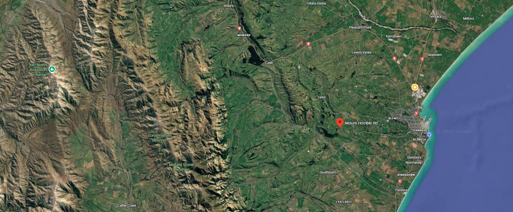
Drive to the top of Mt Horrible Road: This hill known as Waipouri/Mt Horrible is part of South Islands most recent volcanic activity. It is part of the Banks Peninsula–Timaru volcanic field. The area formed when lava flowed like fingers across the landscape around 2.5 million years ago towards what is now the sea forming reefs. The hard basalt (bluestone) created by these lava flows resisted erosion, leaving the elevated landforms that now shape Timaru’s southern hills. Many of Timaru's main roads like North Street follow these rises towards to the ocean. Much of the 'bluestone' has been used in local bridges, culverts, infrastructure, port development, erosion control and buildings was constructed from this quarried volcanic rock. As you drive upward, you are quite literally travelling over the remains of molten lava.
Mt Horrible Road is the remains of an ancient volcanic landscape, which is now extinct with no risk of future eruption, the volcanic field is considered geologically dead.
The well-known Castle Claremont is on this road. It was built for the Rhodes family using local bluestone. It was known as Claremont back then. Now that the trees are taller you can't see much from the road, but the property is available to rent for events and accommodation.
Keep an eye out for bluestone bridges and culverts of the Pareora–Maungati area, survivors of 19th-century infrastructure. They were built mainly in the 1870s and 1880s by local road boards, using locally quarried basalt and lime mortar. They were often produced nearby, to create durable crossings capable of withstanding floodwaters. Constructed by hand, these low, solid structures enabled the movement of people, stock, and goods, linking farms with markets and the port. Still quietly doing their job today, they are easily overlooked, yet they form part of the same working landscape as the water races, dams, reservoirs, and lime kilns that supported settlement and survival in South Canterbury.
Follow the Zig Zag road down from Fairview to Pareora.
Listen for native birds at Claremont Bush: It takes about 30mins walking up hill where macrocarpa and conifers were planted in the 1860s. Along the walk you can see the regeneration of plants including totara, matia, mahoe, hen and chicken ferns, coprosma, cabbage treets, matipo and kowhai. See if you can spy or hear bellbirds(korimako), fantails (piwakawaka), riflemen (titipounamu), grey warblers, brown creepers, and native pigeons (kereru). A wonderful WuHoo is to see the rare native climbing daisy with a bright yellow flower can sometimes be seen in this bush. The turnoff to Claremont Bush Road is about 2km from the zigzag. If you get to the Pareora River bridge you have gone too far. There is a great voluntary effort for trapping pests to help the native flora and fauna. The 3km track is a loop that leads to the top and back down again. No dogs are allowed, no toilets, and no bikes.
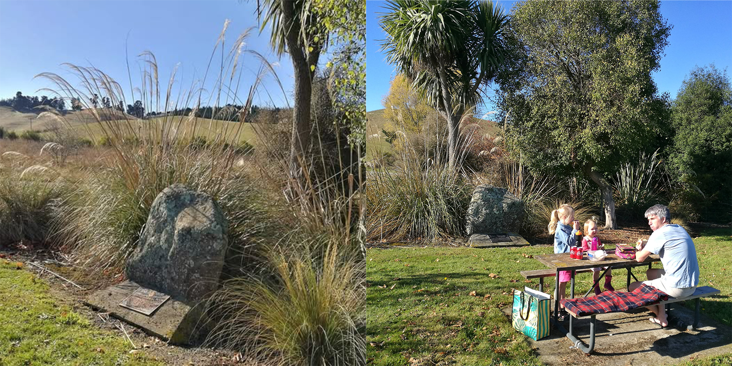
Find the monument for the Holme Station Saleyards: The sale yards were on the corner of the Pareora River Road and Holme Station Road. From 1908 – 2008 the Holme Station Saleyards were in use as a stock sales and meeting place for farmers, stock agents and many others from the surrounding community for a century. See if you can spy the "Holme Station Saleyards commemorative stone." Holme Station was one of the major early pastoral runs in South Canterbury. It was originally part of the Pareora estate, settled and expanded by English pioneer Edward Elworthy from the 1860s onward. Holme Station became a large and influential sheep and farming property inland from Timaru. The yards would have been important to the rural economy of the Timaru district, supporting sheep, cattle and possibly other stock sales in a region where pastoral farming was dominant from the late 19th century on.
The first sale was on February 11 1908. Farmers, went along to get an idea of the price to expect for their sheep. The sale always had "a community feel" and it was always great to see the same people each year. It was the women of the district who were the catering team, they were volunteers, and enjoyed the day as much as anyone working together in the small corrugated tin shed and catching up on the social chatter. They always pulled together to put on the morning tea with fruit cakes and sandwiches.The sale was often during the week but when it fell on a school holiday the farmers would bring their children and wives along and they all knew each other from school. The children played and ran around the sale yards and around the the stock trucks creating a life time of memories.
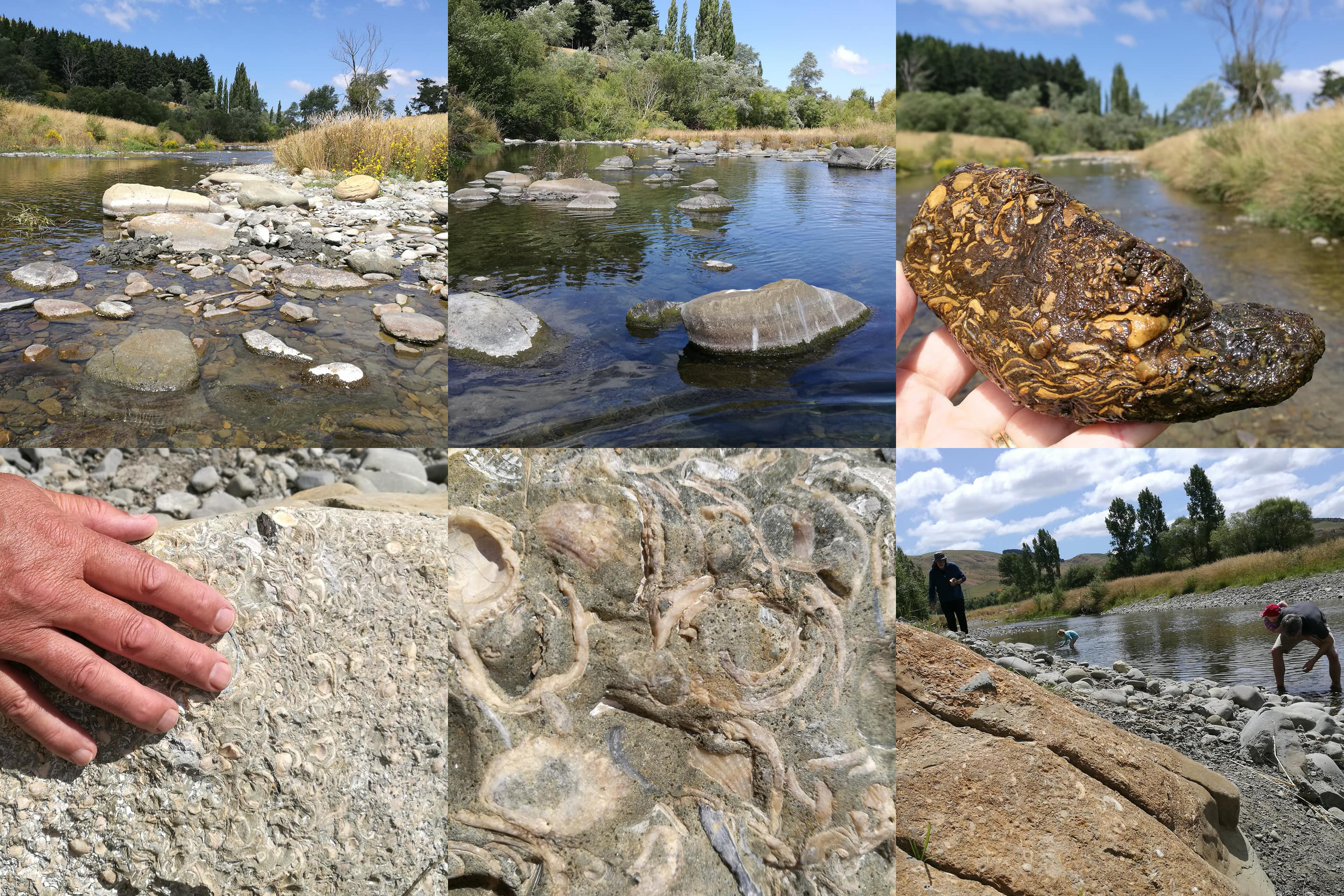
Find fossils in the Pareora River: You can spy fossils on the shore or wade and paddle to find more in the ankle deep river near the Evens Crossing Ford. Park by the river, unpack a rug and a picnic and spend the day paddling, throwing rocks, catching cockabullies. Look for limestone rock that is smooth on one side, with fossils that could be 50 million years old on the other side. Sadly the river is not in great health and is often unsuitable for swimming. The Pareora River/Pureora at Evans Crossing is the upstream site on this hill-fed river in South Canterbury. You can check here: https://www.lawa.org.nz/explore-data/canterbury-region/swimming/pareora-river-at-evans-crossing/swimsite
The Pareora area is well known for its marine fossils, which come from a time when much of South Canterbury lay beneath the sea. The most common fossils found in river gravels, banks, and nearby sedimentary layers include shells of molluscs such as bivalves and gastropods, as well as brachiopods, echinoids (sea urchins), and occasional shark teeth. These fossils date mainly from the Oligocene to Miocene periods, around 30 to 5 million years ago. They are present because the region was once covered by a shallow sea. Over time, marine sediments built up on the seafloor, trapping shells and sea life. Later tectonic uplift raised these layers above sea level. As rivers like the Pareora cut down through the landscape, they eroded these ancient marine beds, washing fossil fragments into the river gravels and exposing them along banks and terraces.
Fossils in the Pareora area are protected because most are found on public land, conservation land, riverbeds, or coastal areas. Under the Heritage New Zealand Pouhere Taonga Act, removing them without permission is illegal. Fossils are considered part of New Zealand’s scientific and natural heritage, and taking them removes important context needed for research and understanding. Any fossils of scientific importance should be reported to a museum such as the South Canterbury Museum or GNS Science, rather than collected. A good rule of thumb is: look, learn, photograph, but leave them where they are.
See traces of a legacy deserving of recognition is the Downlands Water Supply Scheme, a pre-war Ministry of Works unemployment relief project. Established in the mid-1930s, the scheme has supplied reliable water to farmers in the area ever since and is widely regarded as a lifesaver in this water-scarce landscape.
The scheme arose from the Great Depression (1929–1939), a global economic collapse triggered by the 1929 Wall Street crash. In South Canterbury, the effects were severe as overseas prices for wool, meat, and dairy collapsed, undermining the region’s rural economy. Farm incomes fell sharply, unemployment rose, and hardship became widespread. In response, the government invested in labour-intensive public works, designed to provide paid employment while creating essential, long-term infrastructure.
The Downlands Water Supply Scheme was built largely by hand. Work was deliberately labour-intensive, with trenches dug manually, pipes laid by hand, and concrete structures such as intakes, valve blocks, and tanks formed on site using basic tools and limited machinery. The scheme was designed to maximise employment rather than speed, and its longevity reflects the skill, effort, and workmanship of those who built it.
The scheme itself is a reticulated rural water supply system, using river intakes, storage tanks, and gravity-fed pipelines to deliver water across the dry Downlands. Since the mid-1930s it has underpinned farm viability, stock welfare, and drought resilience, making it a cornerstone of rural life in the district. It stands as a strong example of how Depression-era public works created lasting value for South Canterbury communities.
When visiting the Maungati–Pareora area, this history can still be read in the landscape. Look for concrete intakes and small weirs on the Pareora River, modest valve blocks and inspection chambers, traces of old pipeline alignments, and storage tanks positioned on higher ground to allow gravity feed. These practical, durable structures are hallmarks of pre-war Ministry of Works engineering and quiet reminders of a time when water security, employment, and community survival were closely intertwined.
Walking to the Pareora Dam
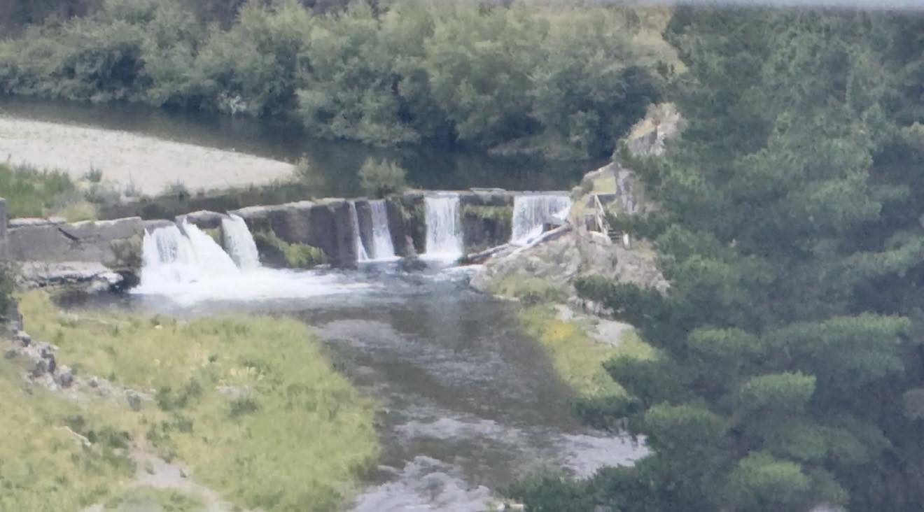
A 40-minute walk follows the route of the original water race to the Pareora Dam, a historic waterworks structure on the Pareora River, about 18 kilometres west of Timaru. The dam was built in 1878–79 by the Timaru Borough Council as part of one of the region’s earliest municipal water supply schemes. It was engineered by Henry Wrigg, the Borough Engineer, and constructed using day labour after contractor tenders proved too expensive.
The dam was commissioned as part of a new water supply system that officially opened on 16 December 1881, following improvements to the original race and intake. This system was developed after the Great Fire of 1868, which destroyed around three-quarters of Timaru’s wooden CBD and exposed the inadequacy of the town’s water supply. The broader scheme included water races, reservoirs, tunnels, and later pipelines, and marked a major turning point in the town’s development.
By the early 1900s, improvements to the system created surplus water that was used to power pelton wheels, turbines, and steam engines, contributing directly to Timaru’s industrial growth. In 1939, the open water race was replaced with a closed pipeline and a new intake dam was constructed further upstream in the Pareora gorge, making the original dam redundant.
The concrete gravity dam, built in a shallow V-shape across a narrow section of the river, now stands as a heritage structure rather than a working one. While the site may look inviting, jumping from the dam is extremely dangerous. The structure has degraded over time and is undermined, and there have been many serious injuries at the site, including the tragic death of a 17-year-old. Swimming near the dam is not advised. At times, the track has also been closed due to nesting falcons, which have swooped at walkers.
There is, however, plenty of shade and space nearby for a picnic, and the walk offers a powerful way to experience the layered history of water, engineering, labour, and survival that shaped Timaru and the wider Downlands.
Following on from this, the historic water supply reservoirs at Brookfield Road form another key chapter in Timaru’s relationship with the Pareora River and water security. Unfortunatly they are on private land and the public can't see them.
After the Great Fire of 1868 exposed the town’s vulnerability, the Timaru Borough Council committed to creating a reliable municipal water supply sourced from the Pareora. Central to this plan was a large storage reservoir on the outskirts of town, fed by a long water race from the river. The first reservoir was excavated in 1874–75 by James Fraser, formed by earth embankments and lined with bluestone and concrete, with a capacity of more than 23 million litres. Although ambitious, the initial scheme failed when water did not reliably reach the town, highlighting the trial-and-error nature of early colonial engineering.
Rather than abandon the project, the council invested further. In 1880, funding was secured to improve the intake and upgrade the water race, and Edward Dobson & Son redesigned the system on scientific principles. When it opened on 16 December 1881, it finally delivered a dependable supply for domestic use and firefighting. As Timaru grew, demand increased, and in 1910–12 the original reservoir was enlarged and a second, concrete-lined polygonal reservoir was built alongside it.
These reservoirs served the town for decades and later supported industrial growth, with surplus water powering pelton wheels, turbines, and steam engines. Although they were decommissioned after new reservoirs were built on Claremont Road in 1960, they remain an important part of Timaru’s heritage. Now grassed and earth-formed, and located on private land, they link directly to the Pareora Dam, water races, tunnels, and pipelines, together telling the story of how Timaru learned to secure water, survive crisis, and grow into a permanent town.
Blue Rocks Swimming Spot: Park at Evans Crossing and walk up the river on the south side to get to the blue rocks swimming hole. The walk way for the Pareroa River walk is on the North side of the river and you'll see the track sign posted for the 40 minute walk to the dam.
NOTE: The council temporarily closes the Pareora Walking Track due to Kārearea - New Zealand Falcon nesting season. Kārearea are known for dive-bombing humans and animals that get to close and as they are nesting within the track this endangered little one could hurt itself or someone walking by too close to its nest which they often make on the ground. There are usually signs at the track entrance, and they provide social media updates when the track is open again (nesting season runs from around September to December). Check out the DOC website here for some cool information about the New Zealand Falcon/Kārearea: https://www.doc.govt.nz/.../birds-a-z/nz-falcon-karearea/

1959: the City and the Province to-day with some interesting glances at the past. Aoraki Heritage Collection, accessed 05/03/2025, https://aorakiheritage.recollect.co.nz/nodes/view/481
Drive through the ford: If you haven’t driven through a ford before, take extra care at Evans Crossing. River levels can change quickly, especially after rain, so only attempt the crossing when the water is low, clear, and slow-moving. A good indicator that it may be safe is when the water sits below the wheel hubs, and the current is gentle rather than pushing sideways, if you wouldn’t confidently walk it, don’t drive it. A 4WD vehicle with good clearance is recommended. Stop first to assess conditions and, if safe, check the depth on foot near the edge. Drive in low gear at a steady pace and avoid stopping mid-crossing. Stopping can allow water to enter the exhaust or engine bay. If the water looks murky, fast, or higher than expected, it is safest to park and walk instead. If the current is pushing strongly or the concrete is hard to see, do not attempt the crossing. Even shallow moving water can move a vehicle. If in doubt, don’t cross.
See Māori Rock Art: The Te Manunui Rock Art Site is one of the few sites that are accessible to the public from 215-275 Frenchmans Gully Road, Maungati. Tangata whenua believe the bird figure ‘Te Manunui’ (the Great Bird) represents New Zealand’s now extinct Pouakai or the Haast eagle (Aquila moorei, previously Harpagornis moorei) that was associated with the Canterbury area. It is easy to get to and the drawigns are clear. A wonderful place to take your family and visitors and to raise public awareness and appreciation of Māori rock art and educating the public about the earliest stages of human habitation in New Zealand.
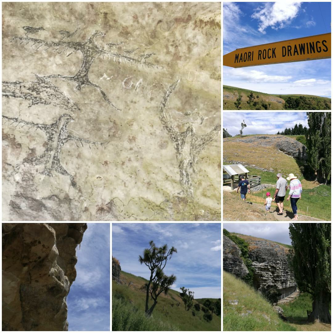
Te Manunui - The Great Bird Rock Art Site (Frenchmans Gully)
A 25-minute drive southwest of Timaru, this site features what is thought to be depictions of birds and human figures. A brief walk from the roadside leads you to a limestone overhang. Give your eyes time to rest and then look for ancient artworks on the walls and ceiling. Please respect the private farmland by staying on the designated path. The Te Manunui Rock Art Site is one of the few sites that are accessible to the public. For tangata whenua, the site is a tangible link to their ancestors’ activities, migration routes, and traditions. The presence of extinct animals and stylistic similarities to Eastern Polynesian art suggest it dates to the earliest phase of Māori settlement in Te Wai Pounamu. Some believe the bird figure ‘Te Manunui’ (the Great Bird) represents New Zealand’s now extinct Pouakai or the Haast eagle (Aquila moorei, previously Harpagornis moorei) that was associated with the Canterbury area. It is easy to get to, and the drawings are reasonably clear. A wonderful place to take your family and visitors, and to raise public awareness and appreciation of Māori rock art, and to educate the public about the earliest stages of human habitation in New Zealand. Historic Place Category 1 in the Canterbury Region
25 minute drive from Timaru via Taiko Vaklley and across Pareora River. 2 min walk from the road side. Note the path can be muddy when wet.
215 Frenchmans Gully Road, Maungati Get Directions - Google Map
Valley of the Moa (Maungati)

Fauth family free fun - exploring the rock art at Valley of the Moa, Maungati. Photos Roselyn Fauth
Valley of the Moa (Maungati) (near Pareora Gorge)
Access is by a short walk from roadside parking. Features: Viewable drawings under shelter, with interpretation panels. Maungati means “mountain of cabbage tree” in te reo Māori, derived from maunga (mountain) and tī (cabbage tree). Once known as Timaunga, the name changed to Maungati, and the local school followed suit in 1979. This rural area in the Waimate District features notable Māori rock art in its limestone formations. Park at the gate, and over a 1 km in-and-back trail. This quiet walk leads you through farmland to a limestone overhang with ancient rock artwork, including drawings of what is thought to be the now-extinct moa. The walk takes around 19 minutes and is suitable for hiking or gentle walking. It is open to the public outside of lambing and calving season (August and September). Please also be respectful of surroundings and do not venture off the marked path. .
92 Moa Road, Maungati Google Map
Take a breather at the Peace Walk: - Rongomaraeroa is a Cherry Tree Walk that was established in 2009 in the memory of Peter Elworthy. While the land is privately owned, the public is welcome. 143 Timaunga Rd, Maungati.
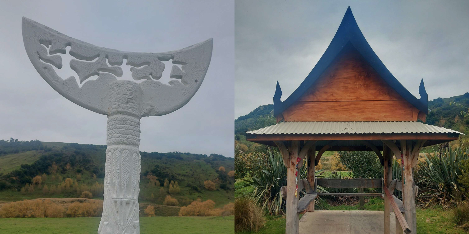
This was created as a place of reflection, remembrance, and reconciliation within the wider Maungati–Pareora landscape. The garden was established as a community-led initiative, shaped by a desire to acknowledge both the deep Māori history of the area and the many layers of settlement, labour, and lived experience that followed.
Drawing on the Māori concept of Rongomaraeroa, the marae ātea or place of encounter, the garden was conceived not as a monument but as a walking space, where peace is understood as something actively made through reflection, respect, and shared responsibility. Its design reflects this philosophy, favouring openness, simplicity, and movement rather than formal structures. The garden sits within land linking to stories of Waitaha, Ngāi Tahu, farming communities, Depression-era labour, and water infrastructure. In this setting, the Peace Walk becomes an outdoor marae ātea, a neutral and inclusive space where people can pause, walk, and consider the impact of conflict and the value of peace across generations.
Plantings, pathways, and views were chosen to work with the existing landscape rather than dominate it, reinforcing the idea that peace is grounded in place. Over time, the garden has become a quiet gathering space for reflection, commemoration, and community connection, adding a contemporary layer to Maungati’s long and complex history.
You can enter for free through a gate off the road and walk quietly, acknowledge what has come before, and consider how peace is carried forward.

See an old limestone kiln: Lime was burnt in small kilns near limestone deposits in South Canterbury from the 1860-1880s. The lime was used as fertiliser for agriculture and as mortar in the building industry and the tanning in de-hairing hides. You can see the pareora Lime Kiln on Pareora River Road. Leg Des: Lot 1 DP 5952 Pt Lot 1-4 DP 4618. Des: Site of first locally burnt lime, built in 1865, then 1882. You can see it from the road, but there is no public access to the site.
The Pareora limestone (lime) kiln is an early industrial site linked to South Canterbury’s development in the mid to late 19th century. Located near the Pareora River, the kiln dates from around 1865, with evidence of use again in 1882, and is associated with some of the first locally burnt lime in the district.
Lime is produced by heating limestone in a kiln to create quicklime, which can then be mixed with water to make lime mortar or applied to land. It was widely used because it was strong, durable, and versatile, making it essential to early settlement. Lime mortar was critical for building chimneys, foundations, bridges, culverts, and stone or brick structures. In agriculture, lime was used to improve acidic soils, increasing productivity and pasture growth, while in tanning it played a role in processing hides.
Producing lime locally was key to settlement and self-sufficiency. Imported lime was expensive and slow to arrive, so local kilns enabled rapid building, farm improvement, and infrastructure development at a time when South Canterbury was growing quickly. The kiln was located here because of the area’s accessible limestone geology, fuel supply, and transport routes.
Like many rural kilns of the period, it was likely a small stone-built “pot” or “draw” kiln fired with wood. Although modest in scale, the Pareora lime kiln represents a foundational industry that supported construction, agriculture, and economic growth, adding another important layer to the working landscape of the Pareora–Timaru area.
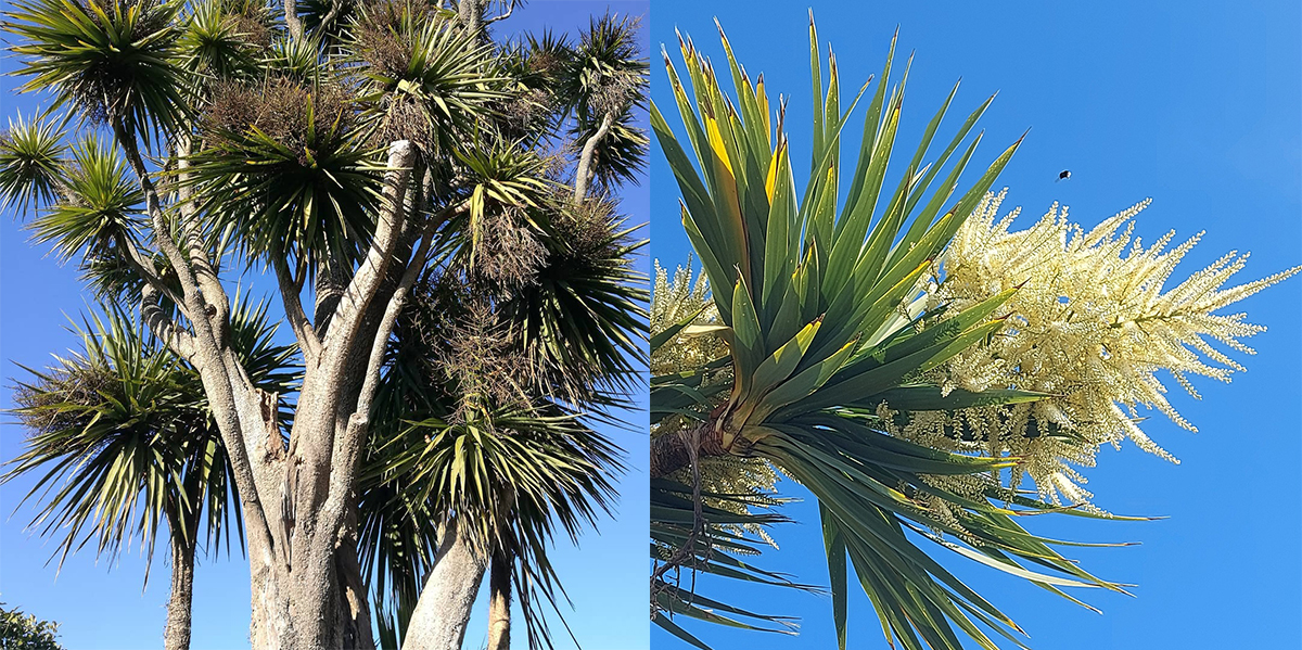
Look for Ti Kouka (Cabbage Trees): They are markers and for Māori, tī kōuka was a highly valued resource. Almost every part of the tree was used. The roots (kauru) were slow-cooked in earth ovens to produce a sweet, energy-rich food. Leaves were stripped and woven into ropes, baskets, sandals, and rain capes, prized for their strength and durability. Tī kōuka also held cultural significance, often planted deliberately near settlements, travel routes, and food-gathering places, making them living markers of occupation and movement through the land.
Early European settlers quickly recognised the usefulness of cabbage trees. They used the leaves for thatching, fencing, and binding, and valued the trees as natural shelter and windbreaks for stock. Farmers also learned that where tī kōuka thrived, soils were often fertile and moisture-retentive, reinforcing their role as indicators of productive land.
From a botanical perspective, tī kōuka is one of New Zealand’s most resilient native trees, capable of surviving flooding, drought, fire, frost, and heavy grazing. It regenerates readily, supports a wide range of insects and birds, and flowers prolifically, producing nectar-rich blooms that are important for pollinators. Its distinctive form, with multiple branching heads, is a response to damage or stress, allowing it to recover and continue growing.
For the advanced try all 34 routes rock climbing up Mt Horrible: The landownders are Penny and David Seyb. There is no need to contact them before climbing. Please observe the usual courtesies and show respect while climbing on their land. Mt Horrible is a plug of quality basalt very close to Timaru. If you enjoy trad climbing on good pro and sound rock then this is the place for you. The routes are quite short but have an abundance of well-rounded holds and cracks that vary from finger width to semi off width. https://climbnz.org.nz/nz/si/canterbury/south-canterbury/mt-horrible
Whale Bones Corner: Ever thought, if I stuck some whale bones near my house, it would make it easier to find? Worn by weather for over 100 years, you can see the remnants of four whale bones which were brought out from the whaling station on Caroline Bay about 1870. Mr John Machintoch, who built the house on the farm Kingsborough about the tome instructed John Webster to collect the bones on a dray and to place them a the intersection so the visitors could be easily directed to Kingsborough. Since then, this intersection has always been known as The Whalebones Corner. (Take care is stopping here and park well away from the intersection).

Zig zag to the Taiko Hall: Built in 1906 was originally a school, established when the government divided up farm district estates into smaller areas. Taiko School closed in 1948 and the building became a center for activities in the Taiko community. It was a hub. There was the rifle range, the tennis courts and well-attended dances. Now used for community events, 40th and 50th birthdays, as well as a center for darts and euchre players. The hall would typically be used once a week, on average, for various community events. In June 2016 a new roof was put on. The community raised $23,000 for the project. The hall's last major renovation was completed in 2012 when the toilet block was given an upgrade, getting new toilets and a linoleum floor. Opposite the hall is a war memorial.
Over the road is the Taiko War Memorial, reflecting the strong community response to the losses of the First and Second World Wars, serving as a place of remembrance for local families and descendants. The memorial recognises the impact of global conflict on small farming communities, where the service and sacrifice of local people were deeply felt and remain part of local history.

Notice areas of riparian planting along streams and river margins As you move through the Pareora–Maungati farms see if you can spot plantings by the waterways. They are the result of ongoing work by local farmers to protect waterways and improve environmental health. Riparian planting helps stabilise riverbanks, reducing erosion and sediment entering the water. Native plants act as natural filters, trapping nutrients and runoff from farmland before they reach streams, which improves water quality. Shading from trees also cools the water, creating better conditions for fish and invertebrates. In a working farming landscape, these planted margins balance production with care for the land. They reflect a shift toward kaitiakitanga and stewardship, recognising that healthy rivers are essential for farming, ecosystems, and future generations. Over time, these green corridors also provide habitat for birds and insects, gradually restoring connections between land, water, and people.
McKenzie Memorial: Below the shingle zig zag is a memorial and a stand of native trees marking the place at Hika-a-Tama (Taiki Flat) where a flock of 1000 sheep were rustled- believed stolen from the Rhodes brothers - and later found in possession of the Scottish shepherd James 'Jock' McKenzie. Taiko was a Māori who worked for the pastoralist Rhodes brothers and helped locate the missing sheep and McKenzie. He protested his innocence, but was jailed. He escaped twice before being pardoned. His exploits, and those of his dog, won him widespread public sympathy and he became a folk hero. The area where he was apprehended was subsequently named ‘the Mackenzie Country’. This memorial to Mackenzie and his dog is in Fairlie. There's also a picnic table the perfect place to stop for a picnic. At night the sheep were put in yards made with sod walls, and although the yards have since been cultivated, it is still possible to see an outline of them. If you are wondering why a theif might be deserving of a legend, you only have to see the country he went through. Imagine what it was like before there were tracks, fences, trees and willows. Just plenty of spiky matagouri. James Mckenzie was later pardoned. Although spelled differently, the Mackenzie district was also named after James McKenzie, who over the years has become somewhat of a local folk hero.
St David’s Memorial Church: St David’s was built by runholder and Member of Parliament T.D. (Thomas David) Burnett at his own expense in remembrance of his parents Andrew (1838-1927) and Catherine Burnett (1837-1914), who took up Mount Cook run (Mt Cook Station) in May 1864, and “in the wildness founded a home”. Opened in 1930 and constructed without using any nails, the church is named after St David, the patron saint of all shepherds. Inside, bluestone tablets set at intervals in the nave wall list the first and second wave of South Canterbury station run holders. Further along Burnett’s Rd is another interesting piece of local history, also connected with the Burnett family. The often photographed Burnett Homestead Gates to “Aorangi”, the family’s lowland farm, were built during the 1933 depression and illustrate the class structure of the time, with a main gate for the residents and separate side gates, one for English workers, the other for Irish workers. In 2018 the South Canterbury Museum received a ceremonial silver trowel presented to local MP Thomas Burnett in 1926 at the laying of the Temuka Public Library foundation stone.

Cave War Memorial: This is marks and reminds us of the impact of global events on a small rural communities. It records the names of local men who served and those who did not return, ensuring that their lives are remembered not as statistics, but as individuals rooted in families, farms, and everyday life. For rural places like Cave, the losses of the First World War were felt deeply. During the war, small towns and farming districts sent a disproportionately high number of men overseas. With small populations, each name represented a significant absence. The memorial became especially important in a time when most soldiers were buried overseas and families had no grave to visit. It provided a local place to grieve, remember, and come together, particularly at ANZAC services.
About 100,000–103,000 New Zealanders served overseas in the New Zealand Expeditionary Force during the First World War, out of a population of just over a million. Roughly 42% of men of military age served in the NZEF. Around 18,000 New Zealanders were killed in or because of the war, and about 41,000 were wounded. Nearly every community in the country was affected, and many men did not return to their pre-war lives because of injuries or illness caused by the conflict. The return of wounded soldiers, combined with the devastation of the 1918 influenza pandemic, left communities physically and emotionally exhausted. Annual remembrance helped people process shared loss and reinforced the bonds that held rural communities together.
Today, the Cave War Memorial remains important as a place of reflection and continuity. It reminds us that peace and stability were hard won, that small communities carried a heavy burden, and that remembrance is an act of care for both past and future generations.
Cave, has a sweet wee church that has been developed into a home. You can see the remants of the rail line that the Fairlie Flyer steam train used to chug down and huge boulder with a time capsule underneith. "Near this spot the residents of Cave and its environs celebrated the millennium 1999-2000. A time capsule is buried here to be opened in the year 2100."